PHOTOGRAMMETRY, MAPPING, 3D MODELING & PRINTING, INSPECTION, VIDEOGRAPHY

ONE FLIGHT, ALL SOLUTIONS

FAA Licensed Pilots. Fully Ensured Excellence with quality at it's best!

AeroLand offers enterprise level data solutions in the hands of project managers to deliver high-quality information, imagery and models. With extensive experience in engineering and flying drones, we aim to take imagery to the next level by combining Unmanned Aerial Vehicles technology with powerful software tools, this gives you results like no other. Saving money and time has never been easier and better.

When it comes to produce the most reliable assets for your projects through drone technology, we are the solution you are looking for. Architects, contractors, site owners, engineers, infrastructure professionals and more can benefit from our services.

AERIAL PHOTOGRAMMETRY

Geo-referenced orthomosaics and drone mapping survey, centimeter-level positioning, ready for your preferred GIS workflow, measurements, and calculations.

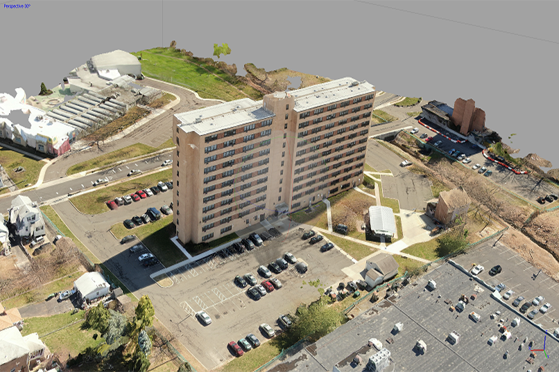
3D MODELING & MAPPING

High-detailed Digital 3D models, Point Cloud based. Applicable to structures, buildings, statues, land, etc.
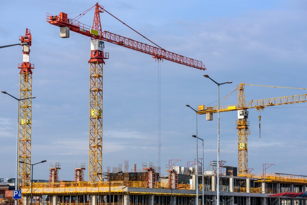
Drones and construction industry

TRACKING PROGRESS

Progress monitoring of any kind of project. Flown monthly, bi-monthly, or custom-dated flights according to your needs.
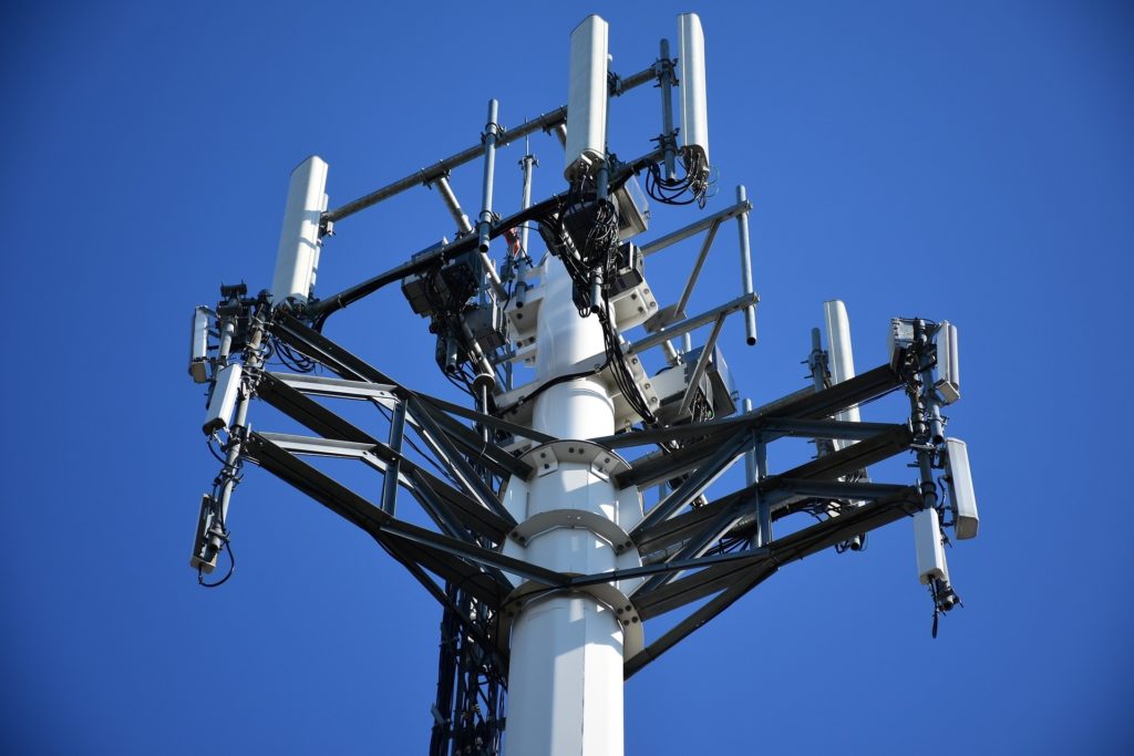
INSPECTION

Inspection of difficult-access structures such as bridges, utility towers, buildings, turbines, pipelines and roofs, or supply accurate 2D or 3D deliverables.

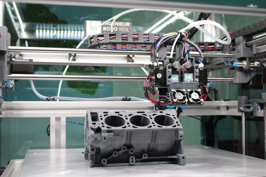
3D PRINTING & PROTOTYPING

3D printing is an affordable technique to create functional prototypes for low cost, in no time and with a lot of freedom.
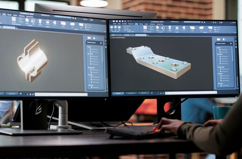
MECHANICAL DESIGN

3D design and scanning services for reverse engineering and computer aided inspection applications.
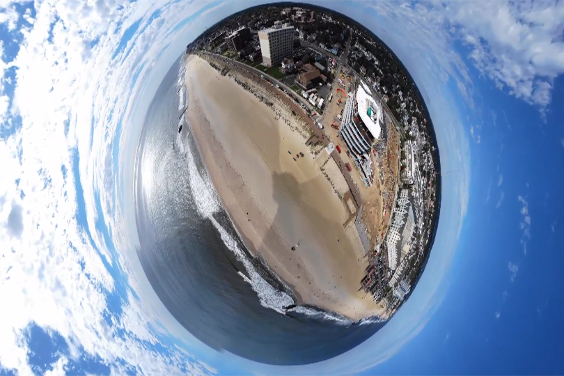
COMMERCIAL IMAGERY

Corporate videos, Real Estate, Marketing & Media, panoramic and 360° pictures. Deliverables with post-production editing or raw files.

CUSTOM SOLUTIONS

Any special project in mind? We are ready to help you. Let’s talk

DRONE SOLUTIONS, FROM SIMPLE TO SOPHISTICATED PROJECTS

Industrial

Construction

Agriculture

Real Estate

LET'S WORK TOGETHER!

Aeroland provides pricing for each project based on individual features, size, and complexity. Our offer is extremely competitive, and you will be saving up to 80% over traditional surveying methods.

The FAA strictly regulates where drones are legal to fly, also there may be hazardous or unreachable places. Therefore, project locations are subject to airspace assessment and approval prior to completion.

Since pricing is based on volume, location, vegetation density, and a multitude of other considerations, we kindly invite you to contact us and let us know all your needs, as well as the features of your project.